FocusedCRE is a fully remote commercial real estate marketing agency, built to collaborate beyond the walls of a traditional studio. We offer the industry a one-of-a-kind outsourcing solution for all your marketing needs, giving you the flexibility you deserve.
About Us
Our industry expertise and focus makes the web development process an enjoyable one. Whether you are looking for a modern website, something more traditional & conservative, or something unique, we are here with you every step of the way to make this hugely important project a successful one.
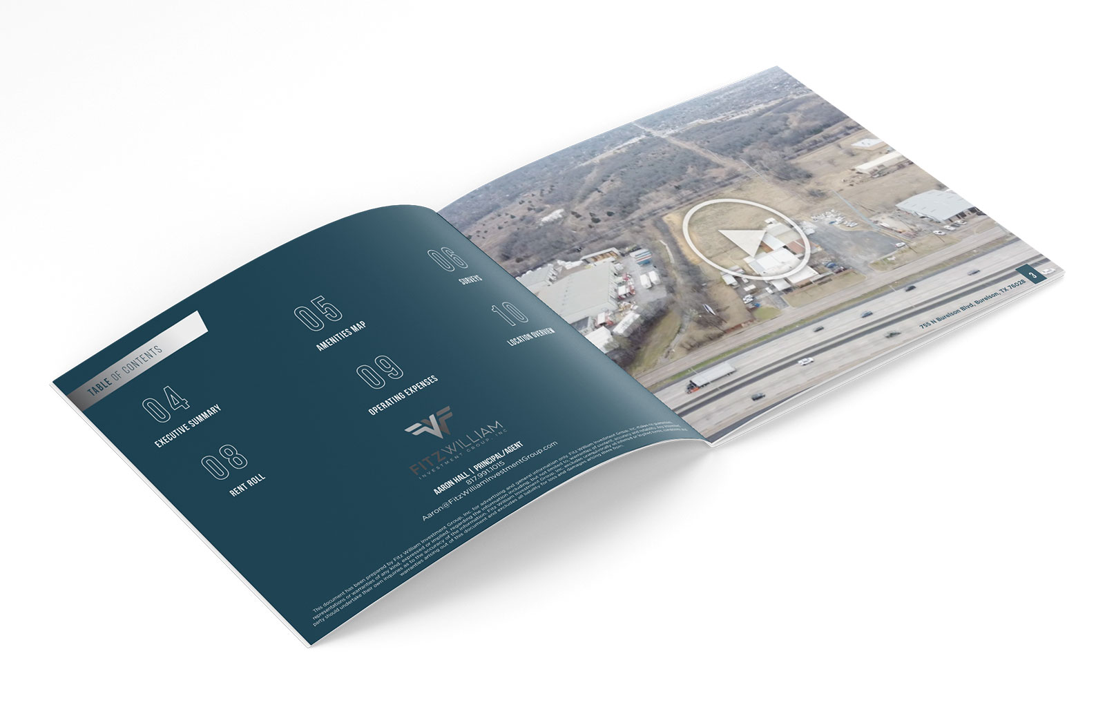
Commercial real estate custom aerial maps are a great way to showcase properties and help clients visualize the property they want to invest in.
FocusedCRE agency is a company that specializes in commercial real estate marketing and development. We use customized aerial maps to help clients visualize the property they want to invest in. Providing digital and printed maps for every type of asset, FocusedCRE knows mapping!
It is not uncommon for commercial real estate agents to have a hard time to find the right property for their clients. They are often looking for properties in remote areas and it is difficult to find them on a map.
FocusedCRE has created an aerial map that includes all the properties that they have listed on their website. This map will help agents to show their clients what kind of properties are available and make it easier for them to find the property they want.
Commercial real estate is one of the most important industries in the world. It is a multi-billion dollar industry that has undergone many changes in the past few years. One of those changes was the introduction of printed commercial real estate maps, custom hunting maps and printed hunting maps.
Aerial maps are an excellent way to show commercial real estate property because they provide a bird’s eye view of the property with detailed information and aerial photography.
The map can be used to show different aspects of the property such as location, size, building type, and year built. It can also be used to highlight any special features, such as amenities or geographical features like rivers or parks nearby. A map can also be used to show zoning regulations that apply to a specific building or area such as zoning districts, height limitations, and setbacks from roads or other buildings.
Aerial maps are a great way to show the scale of a property and the proximity to other buildings. They help potential buyers get a better sense of what they’re getting into.
The map is printed on high-quality paper, so it can be framed and hung on the wall as decoration. It also has an index that will help you find specific buildings in your area or city.
The maps are printed on a large scale, and can be framed for display. They are also available in digital formats.
The maps focus on the locations of commercial real estate properties, which include retail, office, industrial and mixed-use spaces.
Commercial real estate is a business that deals with the renting and selling of land, buildings, and other properties to businesses. Commercial real estate custom printed maps are a great way to advertise properties.
Commercial real estate custom printed maps are an important marketing tool for any business. They are a great way to show off the properties you have available and can be used in a variety of ways to do so.
Custom printed maps, custom aerial maps, printed property maps and satellite maps with property lines are often used as promotional materials or as showroom pieces. They are also commonly used as part of a presentation, to highlight the benefits of a specific property or neighborhood. Maps can also be used to help get your message across by highlighting different features of the property, such as proximity to public transit and schools.
Maps can be created in many different ways, with one common method being aerial photography or satellite photography topographic maps with property lines overlaid on top of it. Topographic maps are often created through surveys that map out all the physical features on the land and give information about elevation, slope, and other physical features.
FocusedCRE offers topographic maps with property lines. These maps are created using aerial photography and satellite imagery, which allows them to be more accurate than traditional property maps.
To find the best commercial real estate custom printed map for you, you should consider what type of property you have and the features that will be most relevant. For example, if you own a commercial property with a parking lot, then you would want an aerial map in order to show it off. If your property is on a hilltop or has a scenic view, then topographic maps would be more appropriate.
Custom satellite wall maps are created by a team of designers, developers, and engineers who have been working with satellite imagery for years.
FocusedCRE is a commercial real estate brokerage firm that specializes in representing the best property listings in all of the US and Canada. The company was established with the goal of providing clients with unmatched service and helping our commercial real estate clients showcase the most desirable properties. The company has grown to become a leading provider of commercial real estate services, assisting clients with all aspects of their marketing from start to finish. The company's success is largely attributed to its focus on client service and its ability to provide detailed information about potential properties.
FocusedCRE agency is a commercial real estate company that provides property maps, local area wall maps, printed property maps, and satellite map prints using satellite imagery for their clients. They provide satellite maps with property lines and aerial maps for their clients to view before they visit the properties.
We are a commercial real estate focused CRE agency with years of experience in the industry. We provide aerial maps, property maps, and satellite maps with property lines. Our topographic maps allow our clients to visualize their properties in 3D.
Commercial real estate custom satellite wall maps are a great way to showcase properties and introduce them to potential buyers. FocusedCRE agency is a company that specializes in this kind of work and they have created some beautiful, informative, and interactive maps.
The commercial real estate topographic maps also include elevation data so you can see how high your new office will be from sea level - if it's close to water or not. This information is especially important for commercial real estate because it will affect how much insurance you need for your new building.
Commercial real estate is a complicated field to navigate. There are many aspects to consider, such as location, property lines, zoning restrictions, and more. The FocusedCRE agency wanted to make it easier for their clients to understand their properties and find the right one by providing them with a custom satellite map, or custom 3d topographic map that would show them all of these things.
The company's satellite maps are created using aerial photography and topographic mapping software. This allows them to provide clients with a variety of different views of the properties they are looking at - from overhead, straight on, or side-on. They can also customize the colors and textures of these maps so that they match their client's branding or the style of their website.
Commercial real estate agents are using satellite maps provided by a knowledgable custom topographic map maker to help them in their day-to-day work. They use it for finding properties, analyzing property lines, and understanding the topography of the area.
FocusedCRE is a commercial real estate agency that provides aerial maps, property maps, and satellite maps with property lines. They also offer topographic maps of the area.FocusedCRE specializes in aerial mapping, property mapping and satellite mapping with property lines. They also offer topographic maps of the area.
FocusedCRE creates custom-made aerial maps to provide their clients with an overview of the location they are looking to invest in. Aerial photography offers a bird’s eye view which allows them to see things like infrastructure, zoning restrictions or easements which might not be visible on the ground level or from street level views.
Commercial real estate is an industry that has a lot of data to analyze. A map is the best way to visualize this data and get insights from it.
Commercial real estate maps are used for many purposes. They can help with site selection, marketing, property management, leasing and more.
Maps are used for many purposes in our lives. They are used to find our way around the city, to discover new places and to plan trips. Maps also help us find out more about the world we live in.
There are different types of maps, each with a specific purpose. Google Maps is a good example of how printable aerial maps and high quality aerial maps free can be used on computers and smartphones. It provides satellite images of the world’s terrain and buildings. It also provides street level views of many cities and towns around the world, which can help you find your way around unfamiliar areas.
Commercial real estate is an industry that uses 2022 aerial maps for its own purposes as well as its clients’ needs. Commercial real estate agents use these maps to get a better understanding of their clients’ property before they visit it in person, or when they need information about their own properties that they have not yet visited in person themselves.
Commercial real estate printable aerial maps using bing maps aerial are a great way to get a bird’s eye view of the property. They can help you find the best spot for your business, research the surrounding area or even find out if there is anything that would affect your property like nearby power lines or flood zones.

