FocusedCRE is a fully remote commercial real estate marketing agency, built to collaborate beyond the walls of a traditional studio. We offer the industry a one-of-a-kind outsourcing solution for all your marketing needs, giving you the flexibility you deserve.
About Us
Our industry expertise and focus makes the web development process an enjoyable one. Whether you are looking for a modern website, something more traditional & conservative, or something unique, we are here with you every step of the way to make this hugely important project a successful one.
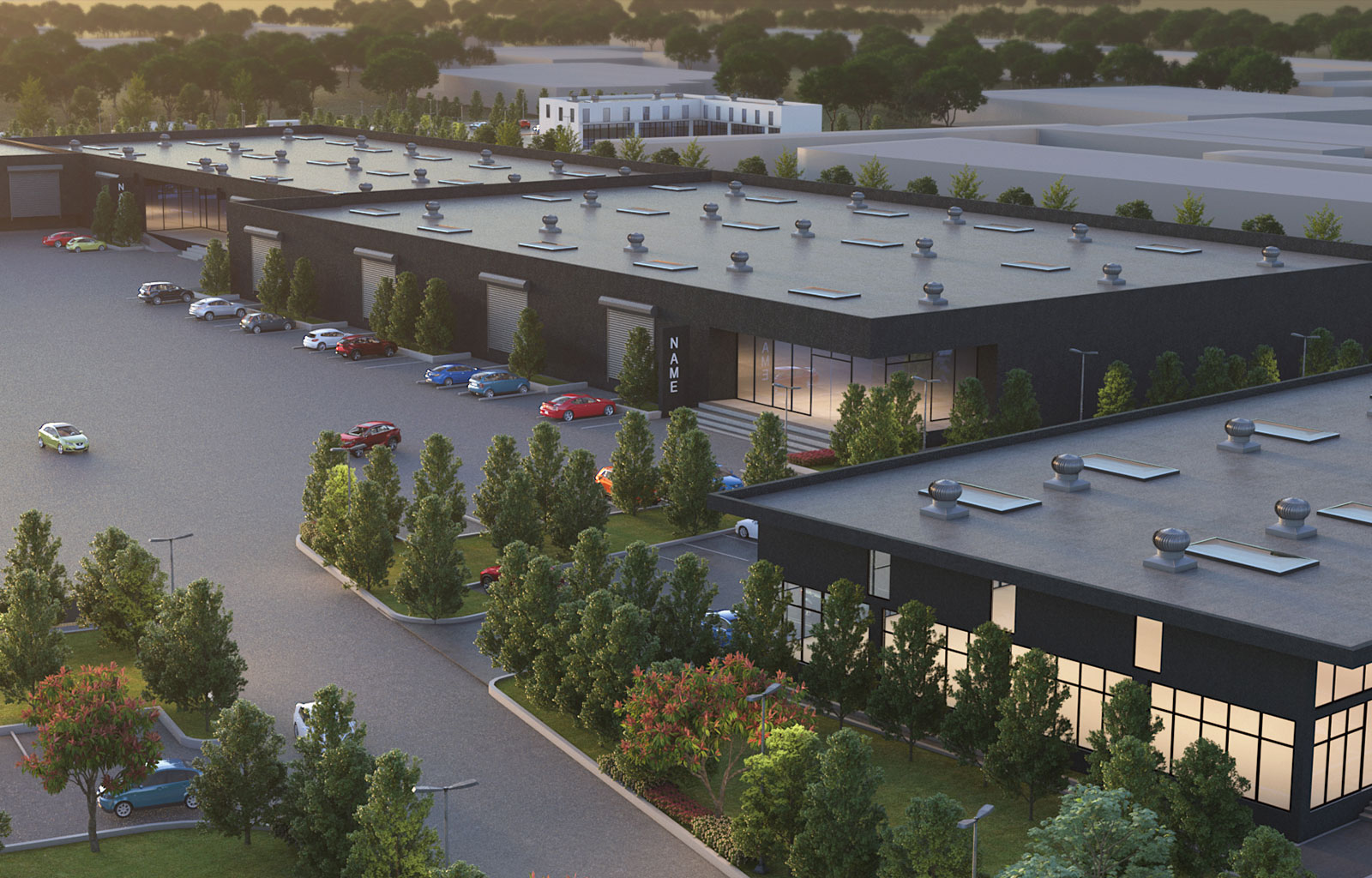
In the intricate realm of real estate, knowledge is power. The ability to comprehend the lay of the land, assess its potential, and make informed decisions is paramount. This is where the marvel of aerial mapping steps in, offering a new dimension of insight that traditional methods can hardly match. At FocusedCRE, we're your gateway to a sky-high perspective, harnessing the capabilities of aerial mapping to elevate your real estate ventures.
Imagine having a bird's-eye view of your property, with every contour, every building, and every inch of land laid out before you. Aerial mapping transforms this dream into reality. By utilizing cutting-edge technology, we capture high-resolution images from above, creating a comprehensive visual representation that provides a wealth of information.
Aerial mapping is a fusion of science and artistry. It involves deploying drones or aircraft equipped with advanced cameras and sensors to capture detailed images of the terrain. These images are then processed to create accurate maps and 3D models. The result is a treasure trove of data that can unlock a multitude of possibilities.
Types of Aerial Mapping: Navigating the Sky's Arsenal
At FocusedCRE, we're not just about providing aerial mapping services – we're about reshaping your perception of real estate. Our team of experts combines cutting-edge technology with years of experience to create a complete picture of your property. From the precision of orthophoto mapping to the detailed analysis of LiDAR mapping, our offerings empower you to make decisions backed by unparalleled insights.
The possibilities presented by aerial mapping are boundless. It's not just about capturing breathtaking images; it's about unraveling layers of information that can drive your real estate endeavors. With FocusedCRE as your partner, you're not only gaining access to advanced aerial mapping techniques, but you're also gaining a deeper understanding of your property's potential.
Ready to explore the world from a new perspective? FocusedCRE is your guiding star. Our aerial mapping services are designed to amplify your real estate ventures, offering clarity, precision, and foresight. Whether you're a developer, investor, or urban planner, our aerial mapping solutions are here to help you navigate the sky and unlock the boundless opportunities that lie beneath.
Discover the world from above with FocusedCRE. Contact us today to take your real estate projects to new heights.

