Custom marketing support for listings, brands, and everything in between.
Let's Talk Find Out More


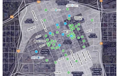
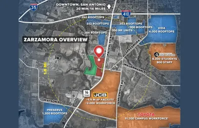
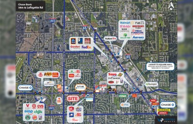
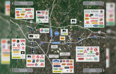


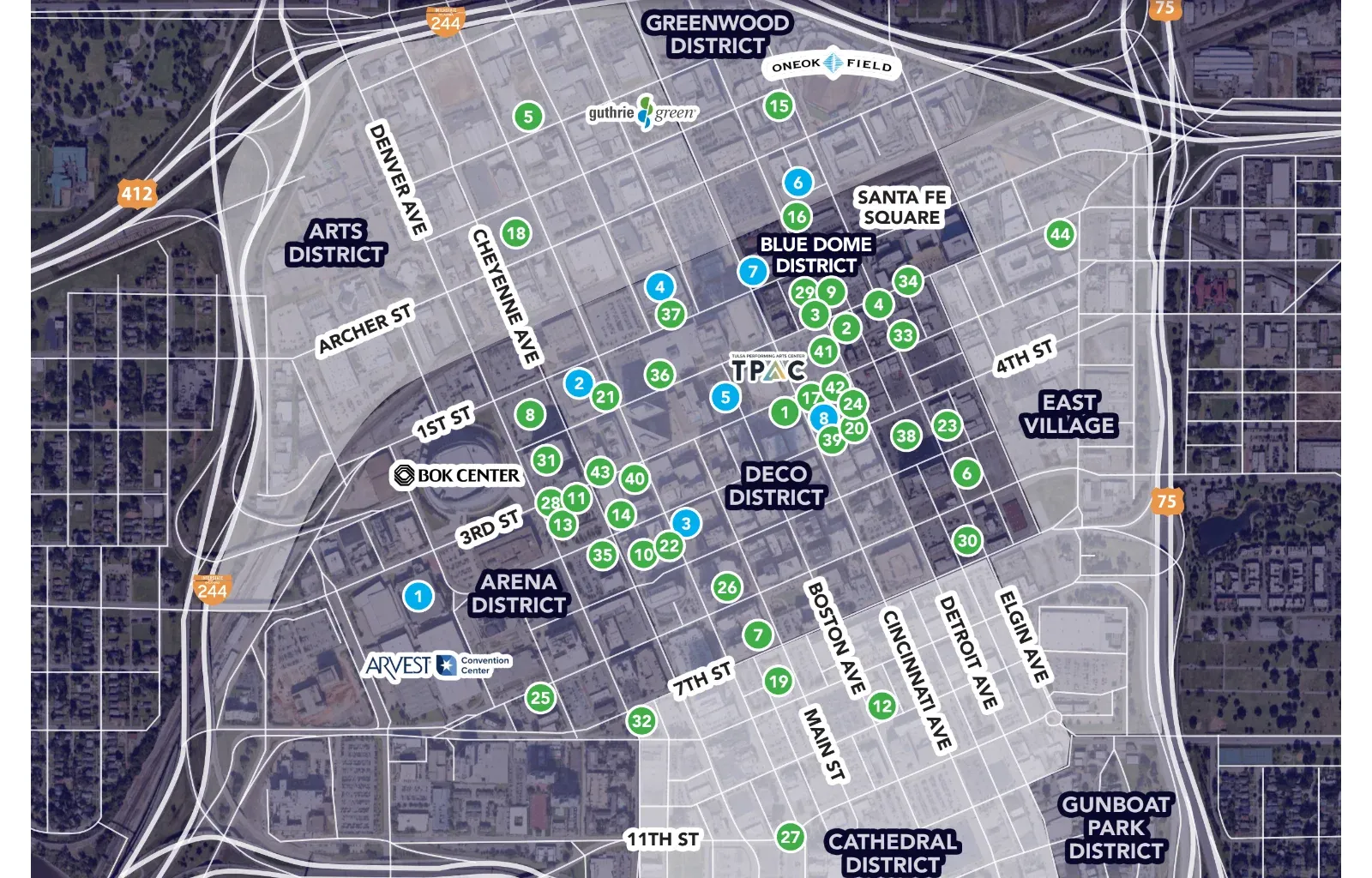
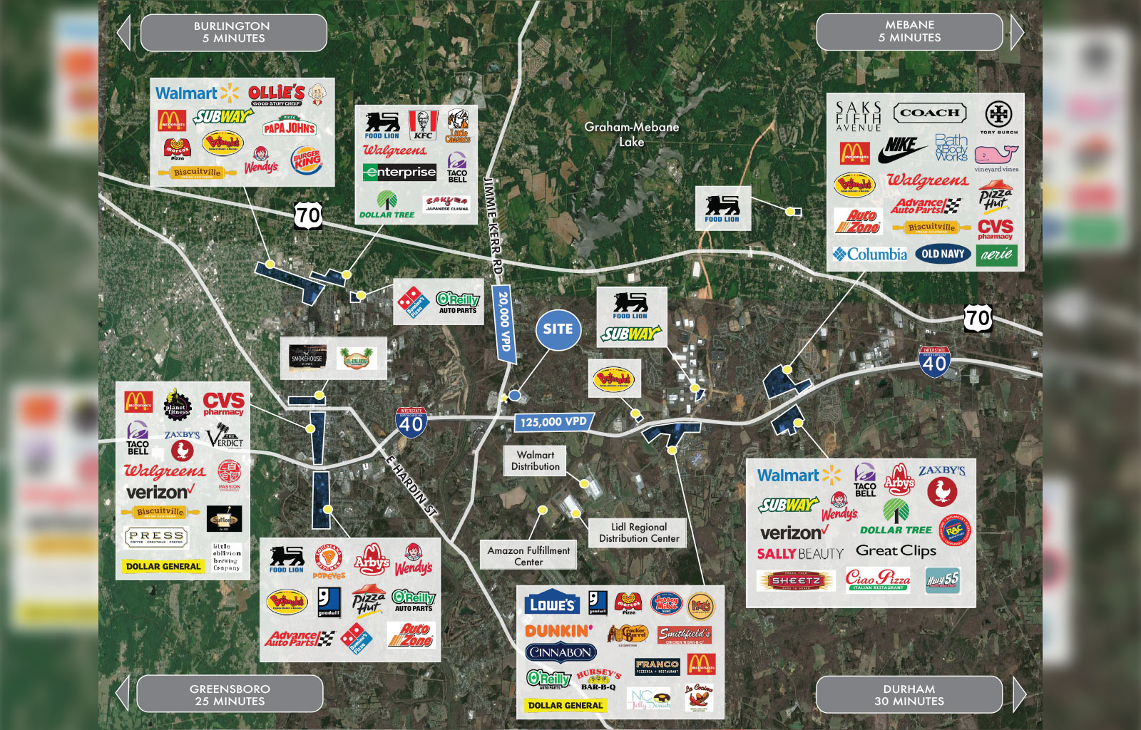
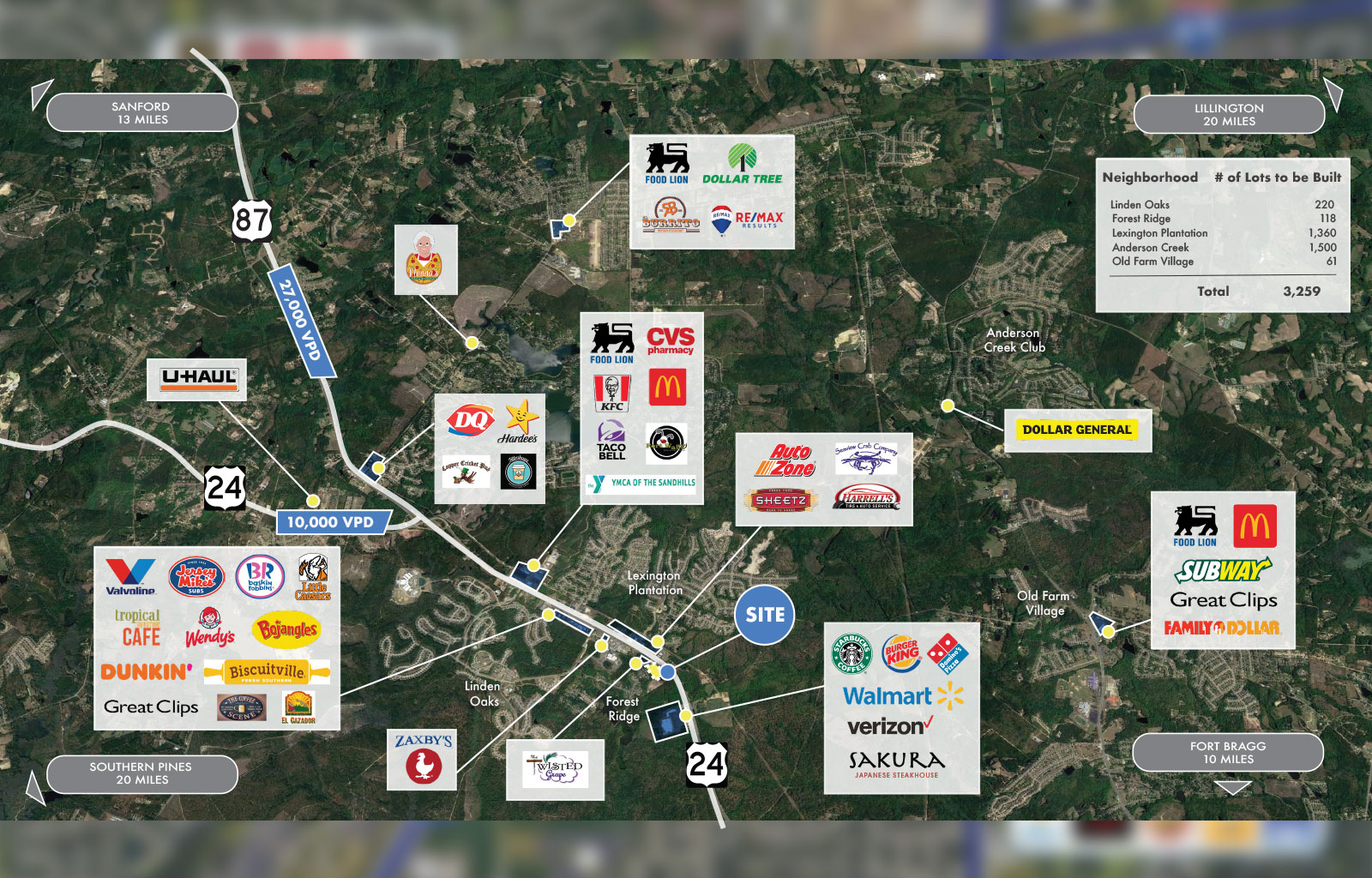
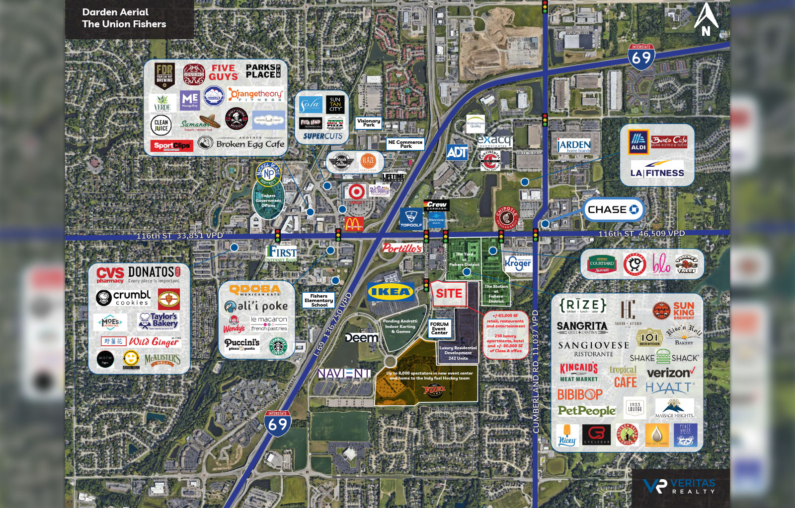
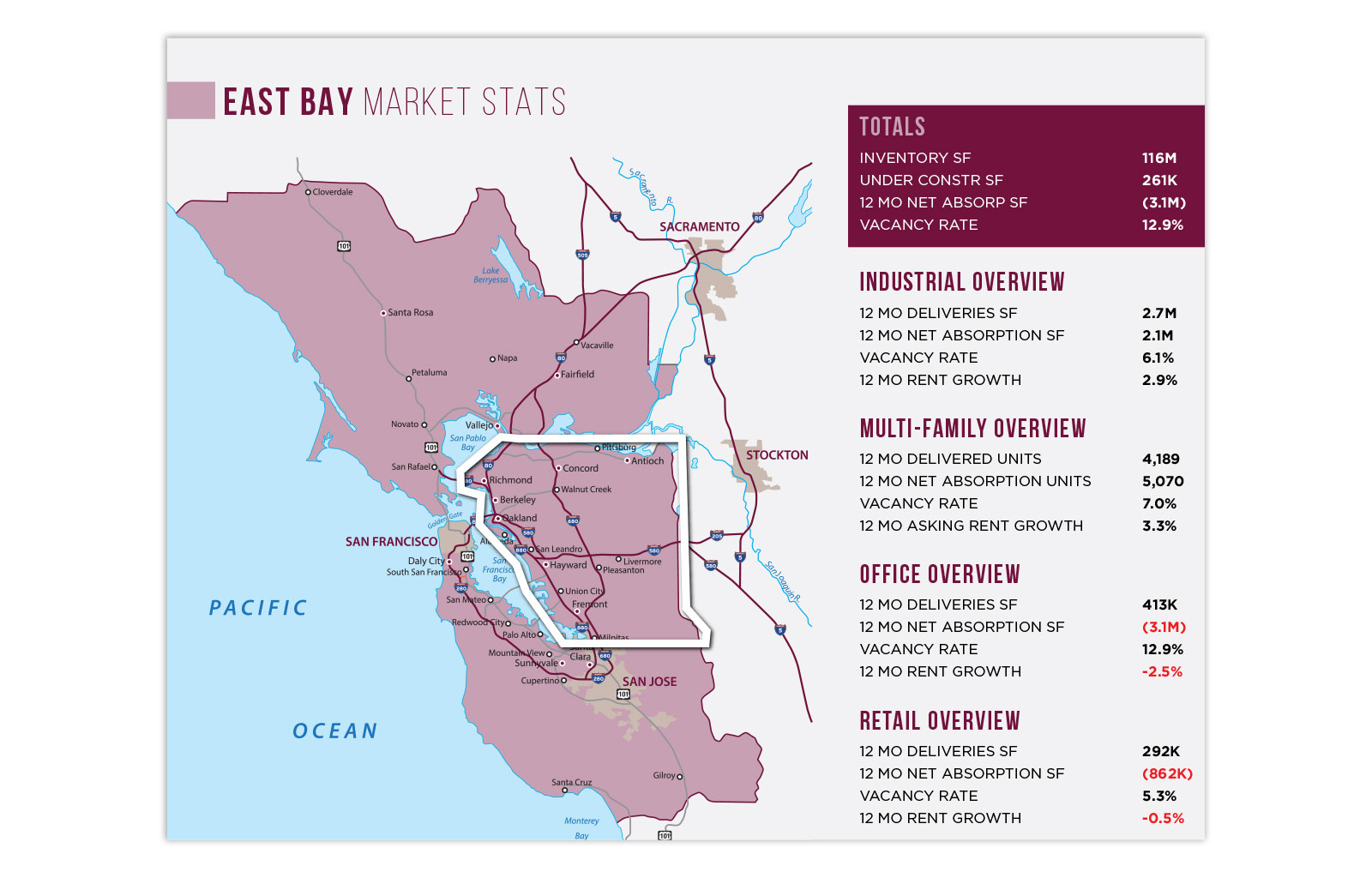
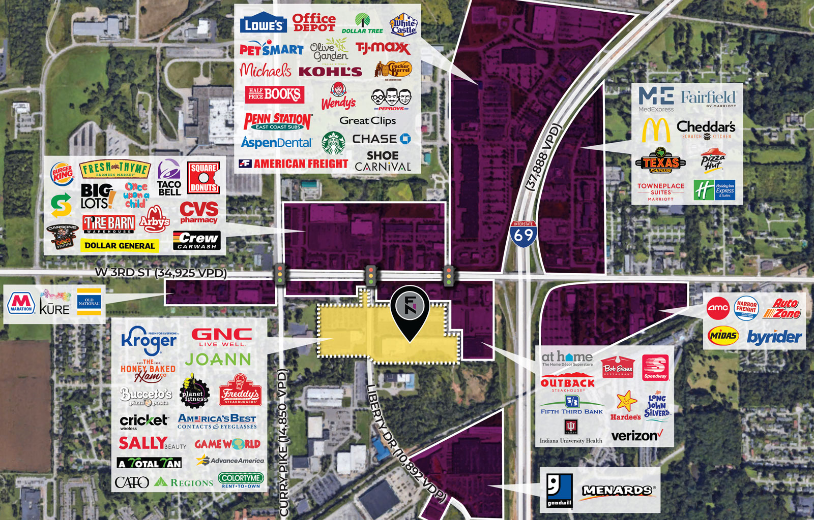
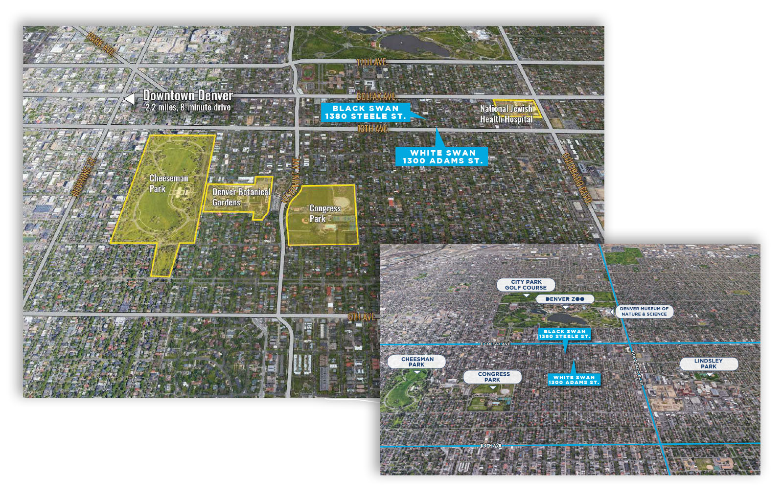
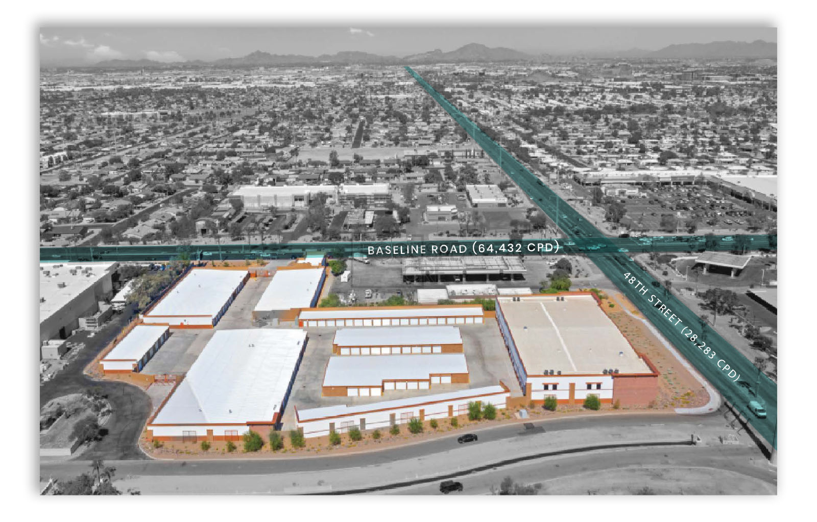
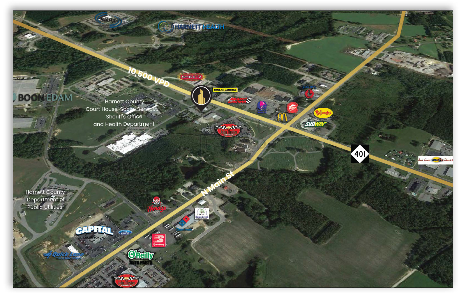
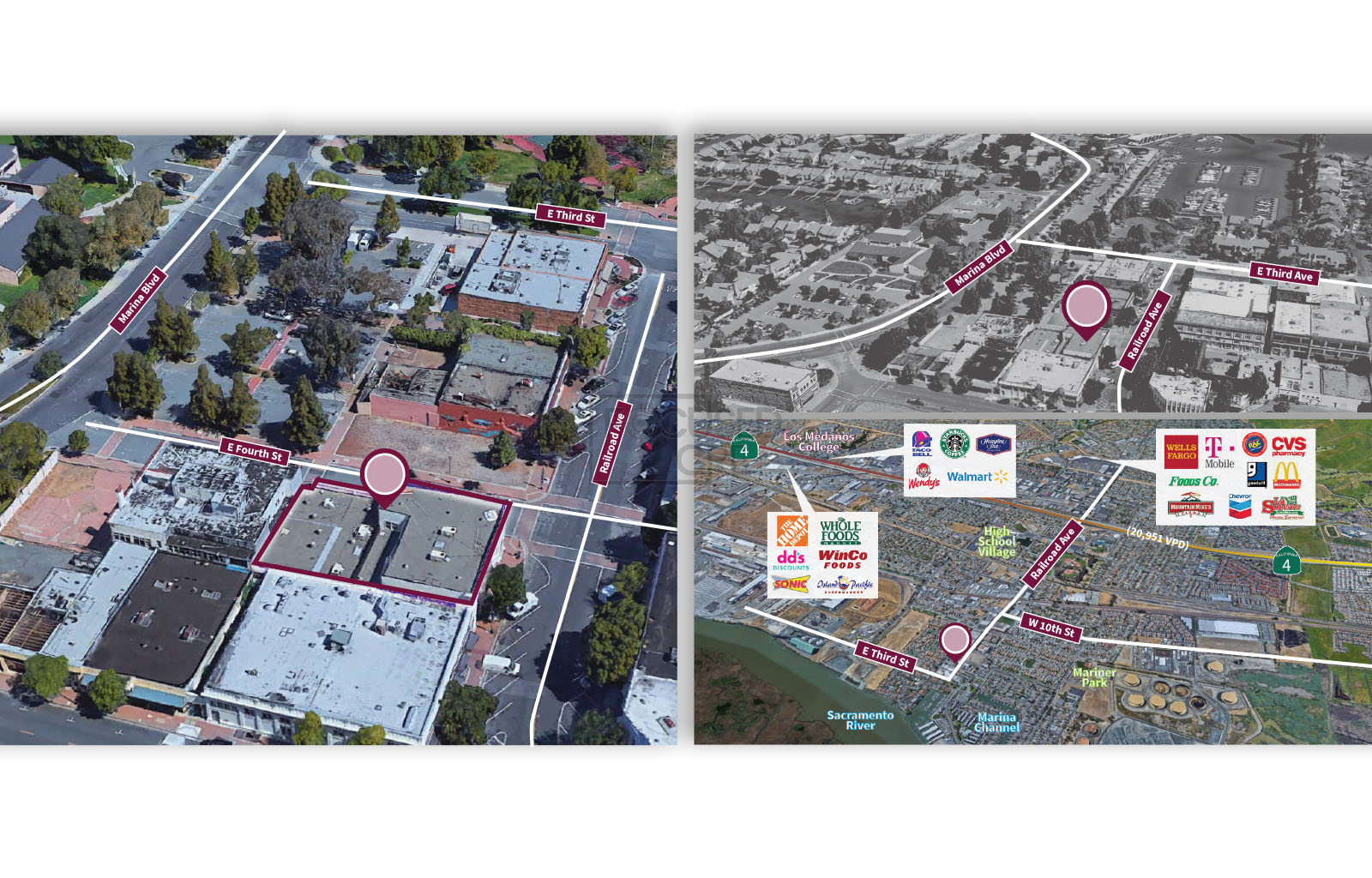
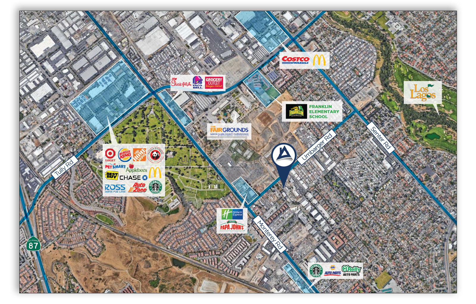
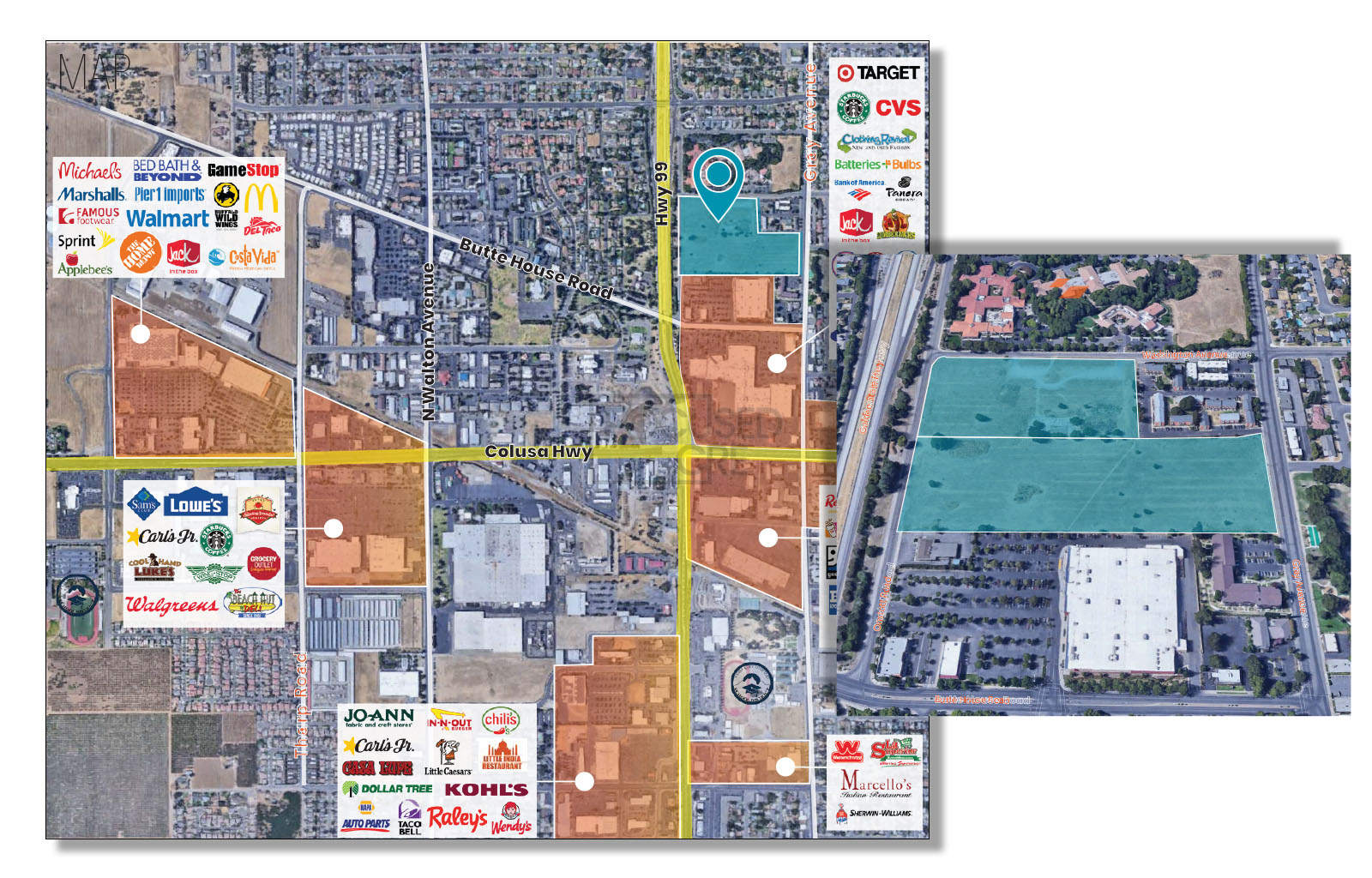
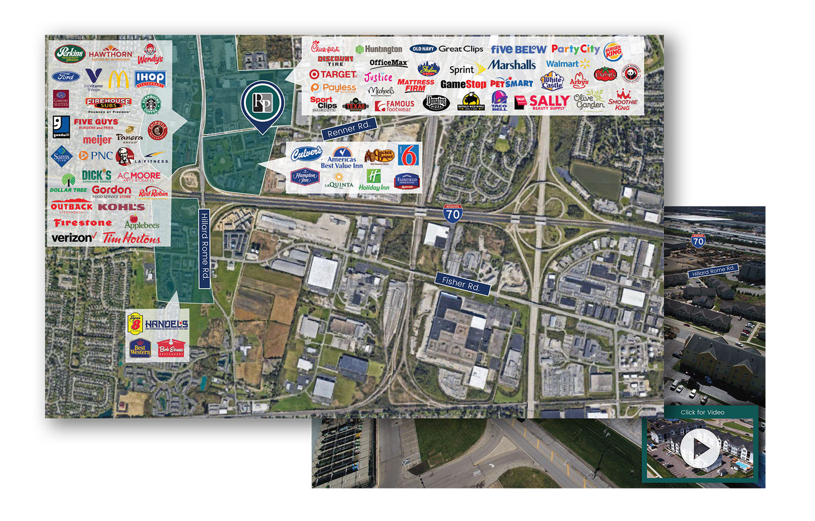
Everyone in commercial real estate knows location is everything, and everyone in commercial real estate – sellers and buyers alike – values a map that illustrates all the finer points of a given location. The best sellers can pitch the benefits of a site’s location until their throats go hoarse and writers can describe the details in copy that dazzles, but nothing beats a smartly constructed map.
Locations are unique and so are your prospects’ needs. A distributor wants access to transportation hubs, especially major interstates. A manufacturer might need a location near rail, or a site far from a city’s hustle and bustle but near a river or port. A retailer wants people and lots of them and plenty of other retailers to help drive traffic. A condo developer wants a view and proximity to all the best shops.
A professionally produced map can showcase all of a given property’s attributes, providing context about its location to surrounding neighborhoods, business districts, infrastructure and more.
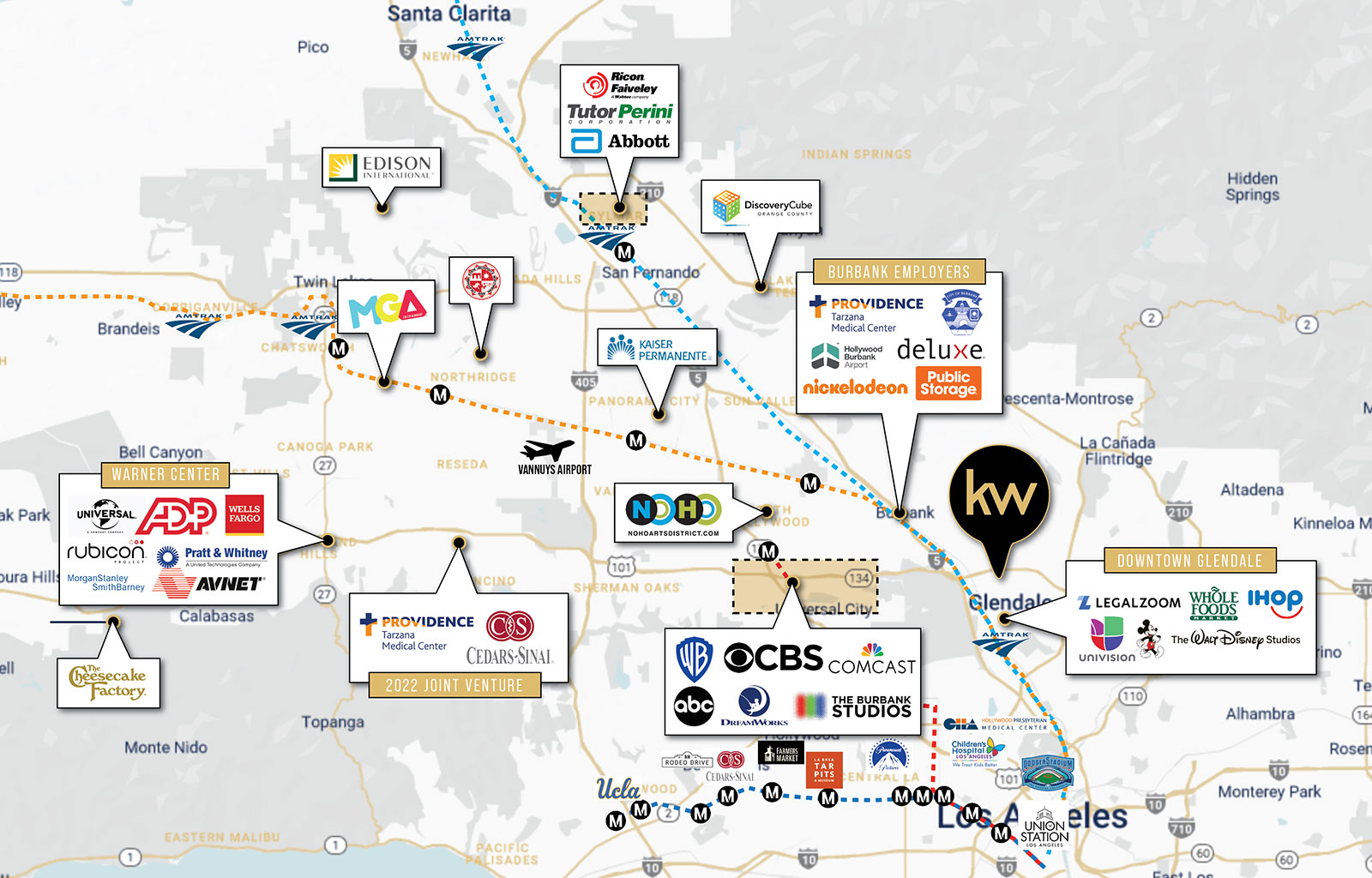
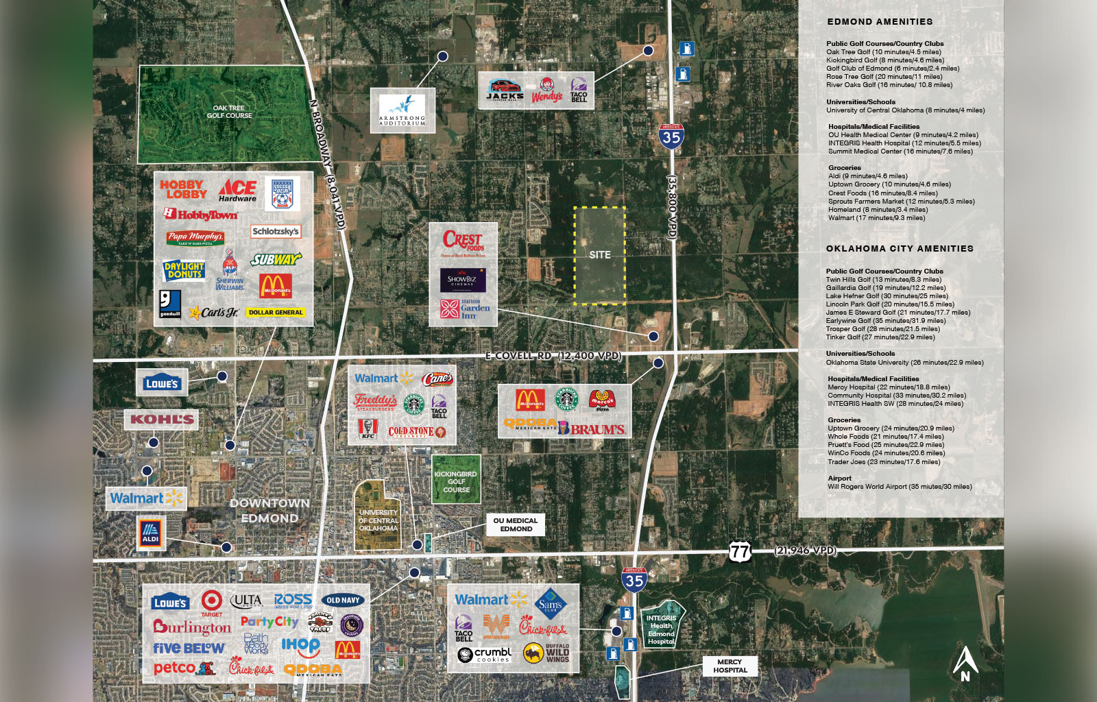
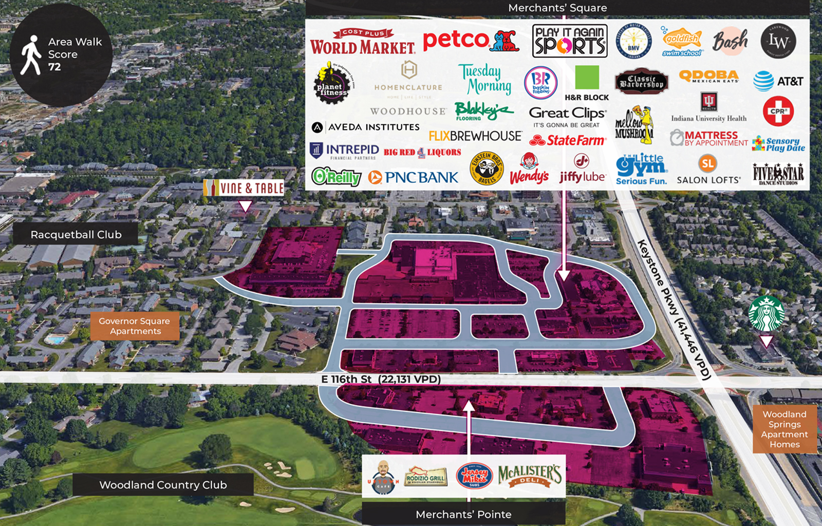
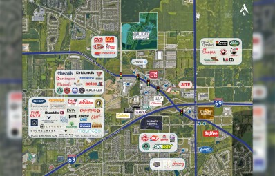
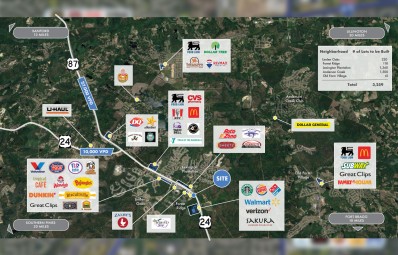
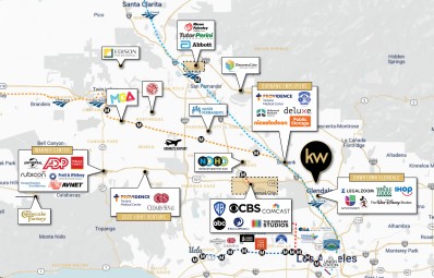
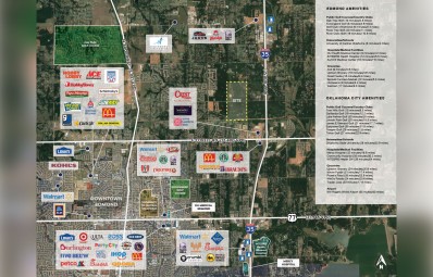
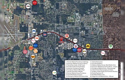
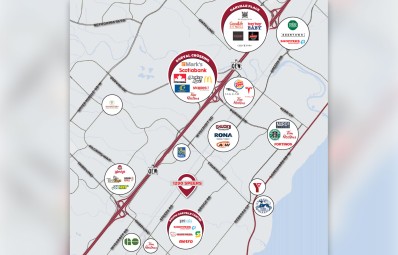
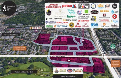
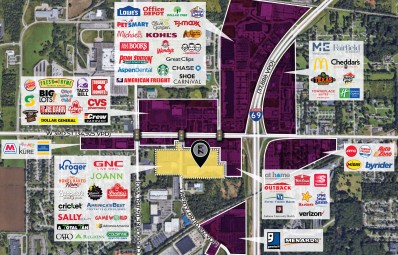
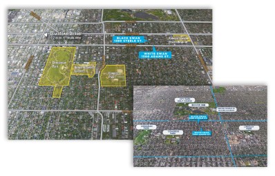
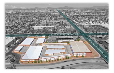
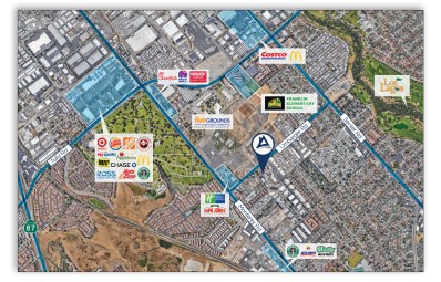
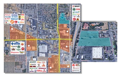
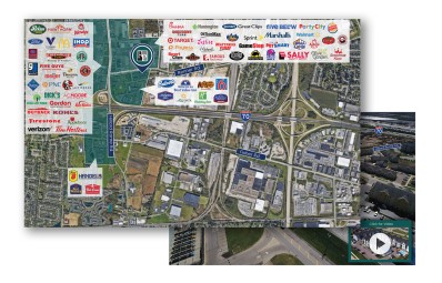
Different types of maps can help accentuate key geographic features, such as public infrastructure, commerce centers and utilities. An illustration can show a site’s location near a main port. An annotated satellite image can demonstrate a site’s value being in a traffic center and use logos to show all the other major businesses already located there.
The possibilities cover a wide range, and so do those who turn to maps, ranging from brokers to landlords to managers. We’ll chart a plan and provide custom maps that show just how out of sight your site is.