
Innovative Marketing Solutions for Challenging Property Listings
3 Jan, 2023
Check out our insight,
its developed just for you!
We want to get your wheels turning and make an impact on your commercial real estate marketing. If any of the below articles stand out and you would like to discuss, please e-mail us and we would be more than happy to discuss!

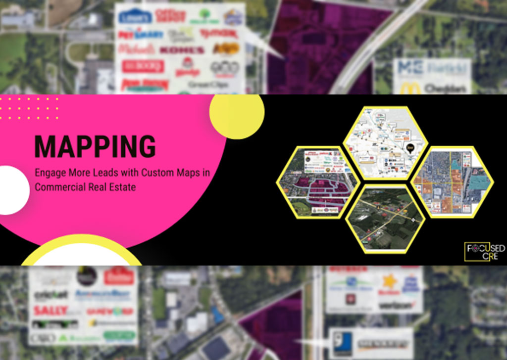
When it comes to selling or leasing a commercial real estate property, first impressions are everything. And what better way to make a smashing impression than with some amazing custom aerial maps? Not only do these maps give potential buyers or tenants a more accurate and detailed view of the property and its surroundings, they can also make the offering memorandum more visually appealing and easier to understand. So, let's take a closer look at some of the different types of maps that may be useful to include in an offering memorandum!
Aerial Maps: A bird's eye view of the property
A custom aerial map is like a virtual tour from above. It shows the property's size, layout, and surroundings, giving potential buyers or tenants a better understanding of its potential uses and value. Plus, an aerial map can highlight the property's location in relation to major roads, public transportation, and other landmarks. And if you want to really impress, you can include information on traffic counts, which shows the average number of vehicles that pass by the property on a daily or annual basis. This can be helpful in evaluating the property's visibility and potential for attracting business.
In addition to all of that, an aerial map can be useful in identifying the specific parcel of land that is being offered for sale or lease. This can help to clearly define the boundaries of the property and give potential buyers or tenants a better understanding of the size and shape of the property.
Google Style Location Maps: A street-level view of the property
Google style location maps, also known as street maps or satellite maps, give a more detailed view of the property's location and surroundings. These maps can show the property's position on a city street map or as a satellite image, making it easier for potential buyers or tenants to locate the property and understand its surroundings. These maps can be particularly useful for properties that may be harder to find or locate using traditional maps.
But it's not just about helping people find the property - Google style location maps can also be useful in showing the property's distance from the nearest city and other major cities. This can give potential buyers or tenants a sense of the property's accessibility and proximity to urban centers. For example, you could include information on the number of miles or minutes it takes to drive to the nearest city or to major cities in the region. This can be helpful in understanding how the property fits into the larger region.
Maps of Retail and Amenities: The fun stuff
If the property is located in a retail area, it can be helpful to include a map that shows the location of nearby stores and restaurants. This can highlight the property's potential as a retail location or as a place for potential tenants or buyers to shop and dine. And to make the map even more eye-catching, you could include logos of the retailers on the map. This can help people quickly identify the different stores and restaurants in the area, and it can also be a useful marketing tool for the retailers themselves.
But retail and amenities aren't just about shopping and dining - if the property is located in an area with a high concentration of amenities, such as parks, schools, and recreational facilities, it can be helpful to include a map that shows the location of these amenities. This can demonstrate the property's desirability as a place to live or work.
In conclusion, custom aerial maps are a fantastic way to market a commercial real estate property and communicate its features and benefits to potential buyers or tenants. By including aerial maps, Google style location maps, and maps of retail and amenities in the offering memorandum, you can provide a complete picture of the property and its surroundings, making it more appealing to potential buyers or tenants. So why not give custom maps a try and see how they can help you close the deal?
[email protected]
Indianapolis, IN
Connect on Linkedin